Shafer Trail: The Historic Road Into Canyonlands
I first learned about Shafer Trail while visiting the Island in the Sky district of Canyonlands National Park. One of my first stops after the visitor center was Shafer Canyon Overlook.
The view was unforgettable.
Standing at the edge of the overlook, you are looking nearly 1,500 feet down into the canyon below. I walked out to the furthest ledge I could find, looked down at the switchbacks carved into the cliff, and thought, one day, I want to bike that and drive that road.
The switchbacks immediately caught my attention.
From above, the road appears to zigzag down the cliff face toward the canyon floor. It is easy to understand why Shafer Trail has become one of the most photographed roads in Utah.
Many visitors stop at the overlook for photos, while others drive the switchbacks in high-clearance vehicles or use the route as the entrance to the famous White Rim Road.
What many people do not realize is that Shafer Trail was never built as a scenic attraction. Long before it became a destination, it was a working route connected to ranching, mining, and the history of southeastern Utah.
What Is Shafer Trail?
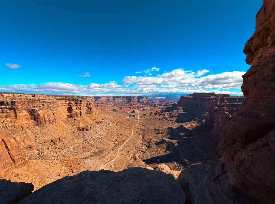
Shafer Trail is a dirt road in Canyonlands National Park that connects the Island in the Sky mesa with the White Rim below.
The road drops more than 1,500 feet through a series of switchbacks carved into the sandstone cliffs. At the bottom, it continues across the White Rim and connects with other backcountry routes throughout the park.
For many visitors, seeing the road from above is enough. The overlook provides a perspective of Canyonlands that is difficult to understand from photographs alone.
Others continue down the trail to explore White Rim Road, one of the most famous backcountry routes in the National Park System.
Where Can You See Shafer Trail?
The best-known view of Shafer Trail is from Shafer Canyon Overlook in Canyonlands National Park.
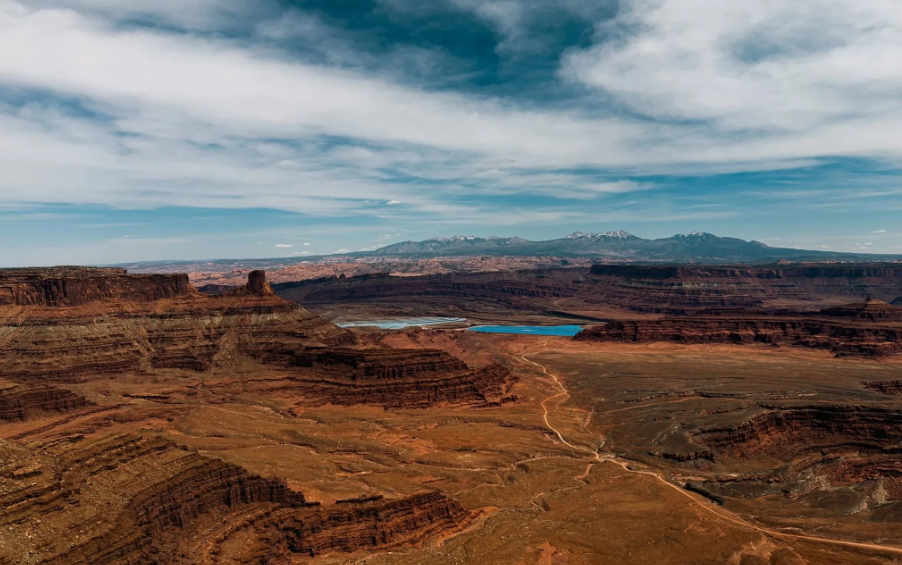
You can also see the route from Dead Horse Point State Park, where several overlooks provide a wider view of how the road fits into the surrounding landscape of mesas, cliffs, and canyons.
From Canyonlands, you look down at the steep switchbacks as they descend from Island in the Sky.
From Dead Horse Point, you can see the larger picture—the road winding through canyon country toward the Potash area near Moab.
Visiting both locations gives you a better understanding of the scale and history of Shafer Trail.
How Was Shafer Trail Built?
Looking down from the overlook, it is difficult to imagine how a road could descend more than 1,400 feet into the canyon.
But Shafer Trail did not begin as a road.
The original route was a trail used by ranchers moving cattle between the mesa top and grazing areas below. Around 1916, John “Sog” Shafer improved and expanded the route, making it easier to move livestock and supplies through the rugged landscape.
Instead of cutting directly down the cliffs, the trail followed natural ledges and sandstone formations. This allowed it to gradually descend from Island in the Sky to the White Rim below.
During the uranium boom of the 1950s, the route was widened again to support trucks transporting ore.
The famous switchbacks seen today are the result of these improvements. The series of turns spreads the elevation change across several miles, making the steep descent possible.
What looks like a carefully designed scenic road today began as a practical route built for everyday work.
The Ranching History Behind Shafer Trail
Before Canyonlands became a national park, this region was used by ranchers who depended on the landscape for grazing cattle.
The Shafer family settled in the area in the late 1800s and needed a way to move livestock between different elevations.
The cliffs and canyons created natural barriers, so routes were developed to connect the mesa top with the lower areas below.
Over time, these early ranching trails became the foundation of what we now know as Shafer Trail.
It was not built for visitors.
It was built because people needed a way to survive and work in a challenging environment.
Shafer Trail and the Uranium Boom
The road gained another purpose during the uranium boom of the 1950s.
Southeastern Utah became an important center for uranium exploration, and roads were needed to move equipment and ore through remote canyon country.
Shafer Trail provided access between the mesa top and the mining areas below.
Today, it is hard to imagine heavy trucks climbing the same switchbacks that visitors photograph from the overlook.
But for a period of time, this was a working industrial route.
How Canyonlands Changed Shafer Trail
When Canyonlands National Park was established in 1964, the role of Shafer Trail changed.
The same landscape that had supported ranching and mining became protected public land.
Shafer Trail remained, but its purpose shifted.
Instead of serving ranchers and miners, it became one of the most recognizable routes in Canyonlands, connecting visitors with the dramatic landscape of mesas, cliffs, and canyons.
The road does not take away from the scenery.
It helps reveal just how massive the landscape truly is.
Can You Drive Shafer Trail?
Shafer Trail is open to vehicles when conditions allow, and many visitors use it to reach White Rim Road.
The route is unpaved, steep, and includes tight switchbacks with exposed cliff edges. Conditions can change quickly after rain, so checking current road conditions is important before driving.
Many visitors simply enjoy the view from the overlook.
Others choose to make the descent and explore deeper into Canyonlands.
A high-clearance AWD or 4WD vehicle is recommended for Shafer Trail. Continuing onto White Rim Road requires additional preparation, including a high-clearance 4WD vehicle, proper equipment, and permits.
You Can Bike Shafer Trail Too
Shafer Trail is also part of one of the most famous mountain biking routes in the country.
Many riders experience it as part of the White Rim Road, a roughly 100-mile loop beneath the Island in the Sky mesa.
For mountain bikers, the descent down Shafer Trail is often the beginning of a multi-day adventure through some of the most dramatic scenery in Canyonlands.
It is one thing to look down at the road from above.
It is another experience entirely to ride through the landscape it connects.
Why Shafer Trail Matters
There are many scenic roads throughout the American West.
What makes Shafer Trail special is the history behind it.
The road connects different chapters of Utah’s past.
Ranchers used it to move cattle. Miners used it during the uranium boom. Today, visitors use it to experience one of the most dramatic landscapes in the country.
Most people first notice the switchbacks.
But the longer you look, the more you realize Shafer Trail represents something bigger.
It is a reminder that people have been finding ways to live, work, and travel through this landscape for generations.
Few roads tell that story as clearly as Shafer Trail.
Shafer Canyon Overlook Location
Island in the Sky District
Canyonlands National Park, Utah
GPS Coordinates: 38.4589, -109.8185