Escalante isn’t the destination.
It’s the place that makes everything around it possible.
This is where you stop before heading down Hole-in-the-Rock Road. It’s where you come back after a long day exploring Grand Staircase–Escalante National Monument—dusty, tired, and already thinking about the next trail, road, or canyon you want to see.
There isn’t much here.
And that’s exactly why it works.
Escalante is the kind of place you appreciate more the longer you stay. It’s not built around attractions or crowds. It’s a small desert town that gives you exactly what you need before heading deeper into one of the most remote landscapes in Utah.
Gas. Food. Coffee. A place to reset.
Then you head back out.
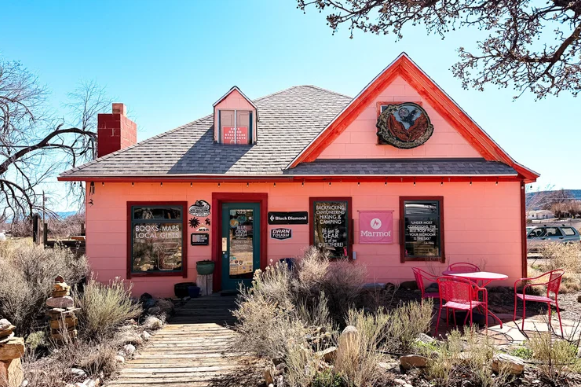
Where Is Escalante, Utah?
Escalante sits along Utah State Route 12, one of the most scenic drives in the country, between Bryce Canyon National Park and Capitol Reef National Park.
It’s also the closest town to Grand Staircase–Escalante National Monument, making it one of the best basecamps for exploring southern Utah’s desert canyons, slot canyons, scenic roads, and remote hiking trails.
For anyone planning to explore places like Hole-in-the-Rock Road, Peek-a-Boo Gulch, Spooky Gulch, Devil’s Garden, or Reflection Canyon, Escalante is where many adventures begin.
Escalante, Utah
37.7703° N, 111.6021° WIf you’re heading toward Hole-in-the-Rock Road, this is where you prepare.
But the story of Escalante goes back much further than modern adventure travel.
A Brief History of Escalante
Escalante takes its name from Silvestre Vélez de Escalante, a Spanish missionary who traveled through this region in 1776 while searching for a route between Santa Fe and California.
But people had been connected to this landscape for thousands of years before that.
Long before modern roads crossed southern Utah, Indigenous cultures lived throughout this region. Evidence of their presence can still be found across the landscape—petroglyphs, archaeological sites, and markings left behind in the sandstone.
Modern Escalante began taking shape in the late 1800s when Mormon settlers moved into the area. They were drawn here by the Escalante River and the possibility of farming, even though the landscape was far from easy.
Water was limited.
The terrain was rugged.
Isolation was part of everyday life.
That isolation is still one of the defining characteristics of Escalante today.
The town sits within the larger landscape of Grand Staircase–Escalante National Monument, where enormous layers of sandstone rise across southern Utah like a giant staircase—from lower desert elevations near the Grand Canyon to higher plateaus near Bryce Canyon.
Those layers create the scenery people come to see.
But they also explain why this area has always been difficult to cross.
One of the most famous routes connected to this history is Hole-in-the-Rock.
Between 1879 and 1880, Mormon pioneers created a rugged route through some of the most challenging terrain in Utah, cutting a path across cliffs and desert country to reach settlements in southeastern Utah.
Standing there today, it’s difficult to imagine crossing this landscape with wagons and livestock.
But people did.
Escalante sits in the middle of that story—a town shaped by the land, and still defined by its remote location.